Why GPRS
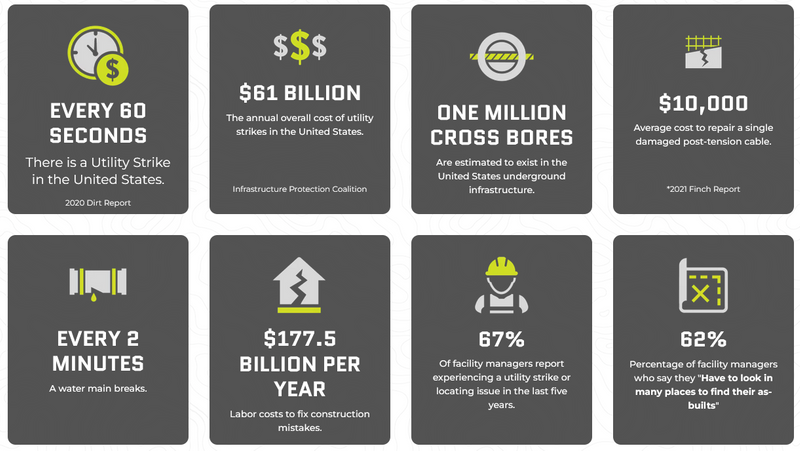
You can’t afford damages, clashes, reworks, accidents, AND budget overruns, AND neither can we.
At GPRS, we believe that controlling data is the key to preventing damage, and we're committed to achieving 100% subsurface damage prevention on every project, across every market, nationwide.
To support this mission, each of our 500 elite Project Managers nationwide is extensively trained in Subsurface Investigation Methodology (SIM). This advanced training transforms a technician into a highly skilled professional, equipped with cross-technology expertise and industry-leading processes. Our team can locate, map, capture, measure, and scan your entire site or facility—both above and below ground—delivering the real-time, actionable insights you need to plan, design, manage, excavate, and build more effectively.
GPRS stands alone in the U.S. as the only company capable of capturing comprehensive site data—above and below ground—to produce precise as-builts, private and public utility maps, 2D CAD drawings, and 3D photogrammetry and Building Information Models (BIM). These resources integrate existing surface and subsurface conditions with construction progress data, providing cloud-based digital mapping and modeling solutions tailored to the construction, architecture, engineering, facility management, and related industries through SiteMap®.
The GPRS Difference
Damage Prevention
Every decision on a job site has the potential to impact time, budget, and safety. That's why GPRS upholds a consistent accuracy rate of over 99.8% in utility locating and concrete scanning and imaging. Our role is to help you keep your projects on schedule, within budget, and, most importantly, safe. Our nationwide team of elite Project Managers goes beyond being expert technicians—they serve as consultants, ensuring you have the precise information needed to complete your job correctly and safely.
Consistent Quality
GPRS is committed to achieving 100% subsurface damage prevention, with a nationwide accuracy rate of 99.8%. Our team of over 500 Project Managers utilizes Subsurface Investigation Methodology (SIM) to deliver reliable utility mapping, concrete scanning, sewer camera inspections, and 3D laser scanning, ensuring consistently high-quality results across every project.
Nationwide Coverage
With over 500 SIM-Certified Project Managers, GPRS delivers nationwide expertise in Visualizing the Built World. Our Rapid Response program ensures swift deployment across all U.S. markets. Specializing in utility locating, we excel in multi-site projects, offering concrete scanning, utility mapping, and CCTV sewer scoping. Leverage our vast experience and comprehensive coverage for seamless infrastructure visualization across the country.
Field to Finish
GPRS ensures a seamless field-to-finish process with 99.8% accuracy. Our Project Managers utilize advanced tools such as ground-penetrating radar, CCTV cameras, and LiDAR for precise data collection. In-house mapping then produces deliverables stored in SiteMap®. After completing utility locates, SiteMap® provides site maps in .pdf, .kmz, and .shp formats, available at no additional cost with a subscription.
-

Ground Penetrating Radar Utility Locating
-
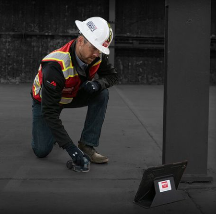
Ground Penetrating Radar Systems Specialist Performing Concrete Scanning
Project Managers Nationwide
Start-to-Finish Project Management
Our team members can assist your project from the scheduling and site walk phase through the reporting and billing phase. GPRS Project Managers are true professionals that deliver industry-leading customer service.
Clear Communication
Our team members ask the right questions before arriving on site. While on site, they will do both a pre-job walk and a post-job walk.
Clear & Accurate Markings / Deliverables
We clearly mark scan results on the surface and discuss all markings, maps, and models before leaving a job site. We offer permanent records like CAD and GPS overlays, and a variety of 2D & 3D CAD & BIM models for Laser Scanning clients.
A Career, Not a Job
Our field personnel are not just technicians, which is why we refer to them as Project Managers. They work beside a client through the entire process, providing excellent service. This is their career, their craft, and their trade. The result? An elite service.
“With so many moving pieces in such short time periods on our fast paced interior construction projects, it is always nice to have a trusted partner we can rely on.”
Jason Hair
Hitt Contracting
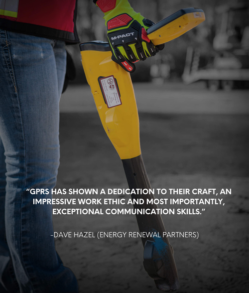
“The GPRS team has shown dedication to their craft, an impressive work ethic while operating in harsh conditions and most importantly displaying exceptional communication skills”
Dave Hazel
Energy Renewal Partners
"I have yet to find a situation when GPRS didn’t accommodate my scheduling and their technicians are always nice and extremely fast in responding."
Michael Pressley
Erm, INC.
"This information was a superior supplement to our investigation?"
Hamid Bahdor
Ellisdon Construction
